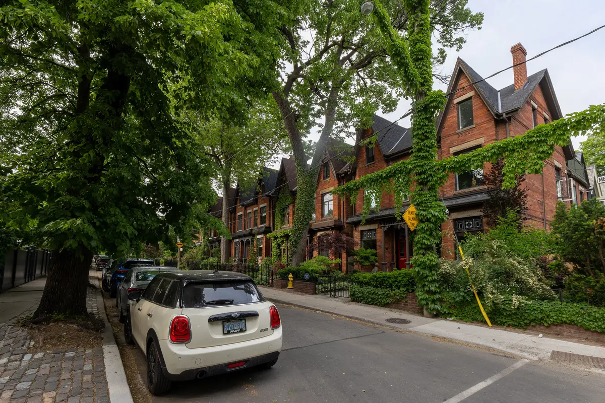
Stand on Metcalfe Street and, according to the Cabbagetown Preservation Association, the view is almost unchanged from a century and a half ago.
That is the Cabbagetown pitch, and it holds up on foot. The CPA says rows of well-kept Victorian houses, narrow lanes and eclectic styles give the neighbourhood the charm of a 19th century village. The City of Toronto goes further and recognizes Cabbagetown as one of the most vibrant residential neighbourhoods in the city, with relatively unchanged streetscapes and many surviving examples of row housing. Here is a loop built around the City’s own heritage district plans, starting at a farm.
What is the Cabbagetown Heritage Conservation District?
It is not one district but a set. The City’s list shows the North, Northwest, Metcalfe and South districts designated between 2002 and 2008. The last piece, Cabbagetown Southwest, came with By-law 260-2024, which designates it under Part V of the Ontario Heritage Act. City Council voted in favour on March 21, 2024. The City says that district began developing in the 1850s, with a significant building period in the 1870s and 1880s.
The neighbours behind the preservation push have a group of their own. The Cabbagetown Preservation Association (CPA) was founded by neighbours who wanted to protect the character and charm of their community, and says its advocacy played a key role in creating the districts. The CPA describes Cabbagetown as bounded by Wellesley Street East to the north, the Don Valley to the east, Sherbourne Street to the west, and Gerrard Street East and Shuter Street to the south.
Why is it called Cabbagetown?
The name dates to the 1840s, when newly arrived Irish immigrants grew vegetables, mostly cabbages, in their front gardens. Wealthier residents elsewhere in Toronto found the practice unrefined and called the area Cabbagetown. Once an insult, the name is now a point of pride. You do not need to pack a cabbage for this walk.
What is the best Cabbagetown walking route?
Our loop has six stops. Take it in any order that suits your feet, and check each organization’s site for current access before you go.
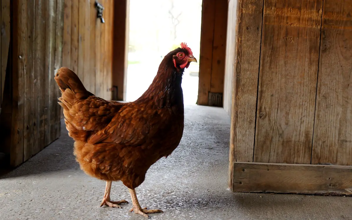
Start where the City starts. Riverdale Farm is a historic working farm with 7.5 acres of wooded areas, ponds and gardens. It has two main gates, one at Winchester and the other at Riverdale Park West. The farm officially opened on September 9, 1978, on land the City bought in 1856. Riverdale Zoo opened there in 1894 and operated until 1974.
The Francey Barn is the one to study. It was built in 1858 in Markham Township and donated to the City in 1977, and it is a Pennsylvania Bank Barn. Three buildings remain from the old zoo: the Donnybrook, the Island House and the Resident Zookeeper’s House, now called the Residence. The City’s Cabbagetown North plan considered it essential to include the farm and the two cemeteries in the district.
Horses at Riverdale Farm, TorontoMagnolia677 / Wikimedia Commons / CC BY 4.02
Two cemeteries opened in the area: St. James Cemetery in 1844 and the Toronto Necropolis in 1850. The CPA notes that they are the final resting places of figures in Canadian history, including George Brown, Robert Baldwin and William Lyon Mackenzie.
Look for the buildings. The City’s plan names two Gothic-inspired cemetery buildings: the Chapel of St. James-the-Less by Cumberland and Storm (1858) and the Toronto Necropolis Chapel by Henry Langley (1872). Our pick for a quiet pause between brick rows.
Winchester is where the Romanesque shows up. The City’s plan points to the row housing at 103 to 109 Winchester Street, along with the Donnybrook Pavilion (1902) at Riverdale Farm, as examples of Romanesque influence. Slow down and read the brickwork.
This is the postcard block. The City’s Cabbagetown-Metcalfe plan says the integrity of unbroken rows of Victorian housing, seen especially on Metcalfe Street, defines the significance of the area’s architecture. That district is bounded by Amelia Street on the north, Carlton Street on the south, Sackville Street on the east and Broadcast Lane on the west. If you only have time for one street, make it this one.
For a change of silhouette, find 397 Carlton Street. The City’s plan calls the James Reeve House (1883) the best representation of the Italianate villa style, and the earliest house on its block.
Finish in the green. The City’s Cabbagetown North plan describes Wellesley Park as the site of Cabbagetown’s only major industrial use, which closed in the 1880s. It is a fine place to sit down and let the rows of houses settle in your mind.
What does a Cabbagetown Victorian house look like?
Learn the look and you will start spotting it everywhere. The quintessential Cabbagetown house is tall, thin, asymmetrical and often semi-detached, with protruding bay windows and a pointed front gable, often decorated with gingerbread. The CPA’s name for the style is Bay and Gable, which is more a description than a label.
The City’s plan lists the same traits for the Victorian row houses in the Cabbagetown-Metcalfe district: tall, narrow bays and gables, decorative woodwork in the gables and, where they survive, decorative wooden porches. Those porches were often added to the house in the 20th century. The CPA says Cabbagetown has one of the densest collections of original Victorian homes in North America.
Aerial photograph of the original Cabbagetown, 1942Toronto Planning Department / Wikimedia Commons / Public domain
Can you take a guided or self-guided Cabbagetown tour?
Yes, and the CPA makes it easy. Its events page lists a guided CPA Walking Tour Program for 2026. For a do-it-yourself afternoon, it also offers downloadable self-guided scavenger hunts: Cabbagetown Architecture, Necropolis Cemetery West and South, St. James Cemetery Northwest and Cabbagetown People Blue Plaques.
Planning ahead? The bi-annual, self-guided Cabbagetown Tour of Homes lists its next edition for September 2027. Check the CPA’s site for tickets and details nearer the time.