City DeskGuide

Downtown Toronto Walking Tour: A Route That Uses the PATH

A self-guided downtown route from Union Station to Sankofa Square that goes above ground for the landmarks and slips into the PATH when the weather turns.

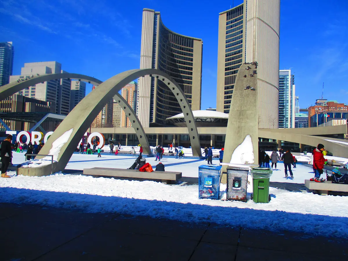
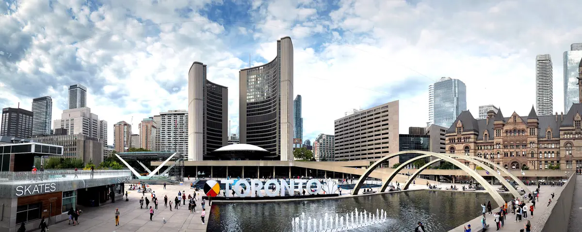
The TORONTO sign and the Freedom Arches on Nathan Phillips Square, with the clock tower of Old City Hall behind
Scott Webb / Wikimedia Commons / CC0

The best downtown Toronto walking tour is the one that still works when the forecast does not.

Which stops are on the downtown route?

Think of this as a line running north from the lake with a few good detours: Union Station, the PATH, Nathan Phillips Square and City Hall, Old City Hall, Osgoode Hall, the Elgin and Winter Garden Theatres, and Sankofa Square at Yonge and Dundas. Every stop is a public place with an official page, and you can drop out at any point. We have not set a time or distance for the route, so move at your own pace. If you want to start with a view, our CN Tower guide is the lakefront prologue.

Where do you start?

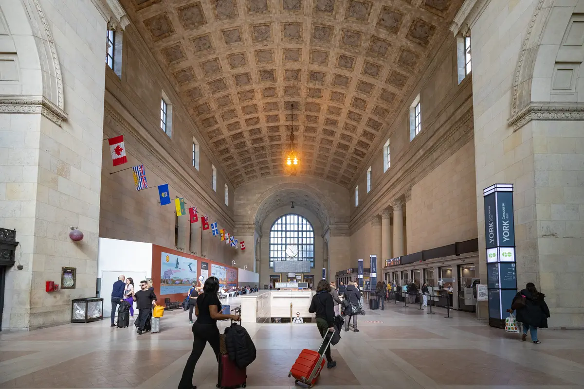
Union Station is an early 20th-century Beaux-Arts-style stone railway terminal on the south side of Front Street, taking up the entire block between Bay and York streets. The Canadian Register of Historic Places says it was designated as the finest example in Canada of classical Beaux-Arts stations from the era of expanding national rail networks. The architectural team included Montreal architects Ross and Macdonald, CPR architect Hugh Jones and Toronto architect John Lyle.

The City says significant restoration was completed in the Great Hall to preserve the station’s original heritage. It also says glass covers over the pedestrian moats on the Front, York and Bay sides create an enclosed space with protection from inclement weather. That is a good reason to start here on a wet day.

If you are coming from the CN Tower, the Tower says the SkyWalk connects to Union Station, and from Union it is a short walk west along Bremner Boulevard or via the SkyWalk.
How does the PATH fit in?

The PATH

The City describes the PATH as a mostly underground pedestrian walkway network that spans more than 30 kilometres of restaurants, shopping, services and entertainment. Six subway stations and Union Station are accessible through it. It is possible to walk through the PATH from the waterfront to Downtown Yonge. Union Station’s Bay Concourse now connects to the PATH through the Bay retail area. Most important for this route, the City says City Hall and Metro Hall are also connected through the PATH.

The practical tips: the Toronto Financial District BIA says the 2018 wayfinding update added coloured pathways to help you plan a route, and signage labelled “Waterfront” identifies the route south to Lake Ontario. Its maps identify grade changes and alternate elevators or ramps for users with accessibility needs. There is currently no app for the PATH map, but downloadable maps are available.

The BIA says most of it is privately owned space, so you are walking through the basements of about 75 different properties, and the City says each segment is owned and controlled by the owner of the property it runs through. Our PATH guide goes deeper.

The PATH, Toronto's underground walkway network.Steve Harris from Toronto, Canada / Wikimedia Commons / CC BY 2.0

What is at City Hall and Nathan Phillips Square?

City Hall is at 100 Queen Street West. The public is welcome to visit a number of spaces on its first and second floors, and visitors entering from the square walk straight into a large, distinctive rotunda. The square outside hosts events year-round, from flag raisings to festivals and concerts.

Outside, look for the TORONTO Sign, which the City describes as one of Toronto’s most photographed landmarks, and Henry Moore’s bronze The Archer. The Spirit Garden is a 20,650-square-foot Indigenous cultural space in the square. In winter the reflecting pool becomes a skating rink, open annually from November to March. Up above, the City has a self-guided walk of the Podium Green Roof, estimated at less than 30 minutes, reached by a ramp on the east side of the square. For the building’s design story, see our City Hall architecture feature.

Which historic buildings are along Queen Street?

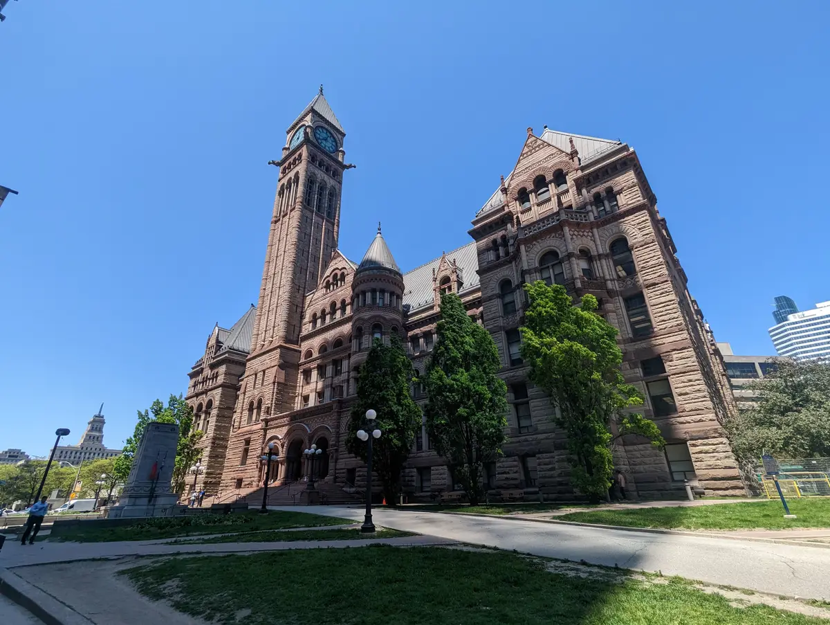
The City says it was built in 1899 to designs by E.J. Lennox and served as Toronto’s City Hall until 1965. A Cenotaph was erected on the lawn in 1925, and the City says it is now the site of one of the longest-running Remembrance Day ceremonies in Toronto. Check the City’s page for current access, which includes ramp access at the Albert Street entrance.

At 130 Queen Street West, the building and its property occupy an entire city block. The Peace Garden was relocated to the west landscaped area of Nathan Phillips Square, right next to it. The distinctive wrought-iron fence and gates around the property were built by Hamilton and Son of the St. Lawrence Foundry.

Osgoode Hall, 130 Queen Street West.Thomas1313 / Wikimedia Commons / CC BY-SA 4.0

At 189 Yonge Street, a rare stacked theatre building with the Elgin at ground level and the Winter Garden above. They were designated a national historic site of Canada in 1982. The best way to see the inside is a show, so check the theatres’ own listings.

Where does the route end?

Sankofa Square, formerly Yonge-Dundas Square, is a one-acre outdoor public and event space at the intersection of Yonge Street and Dundas Street. It sits above Dundas Station on the TTC’s Yonge-University line, so this is a convenient place to end and head home. After a City competition in 1998, Toronto firm Brown + Storey Architects was selected to design it. City Council officially adopted the Sankofa Square name on December 14, 2023, and the name refers to reflecting on and reclaiming teachings from the past so people can move forward together.

Where can you go if you still have energy?

For a longer, building-by-building version of this walk, see the Toronto architecture walk and the Toronto architecture guide.

The PATH is also a place to take a break: the BIA says it is a popular location for pop-up markets, lunchtime concerts and other seasonal events. And for a bit of history, the City says the first underground path in Toronto began in 1900 when the T. Eaton Co. joined its main store and bargain annex by tunnels.

Send this to the friend you would bring on a grey day when you still want a good walk.

Sources (13)
  1. Getting here, CN Tower
  2. Union Station (Canadian Pacific and Grand Trunk) National Historic Site of Canada, Canadian Register of Historic Places (Parks Canada)
  3. Union Station Revitalization Project, City of Toronto
  4. PATH: Toronto’s Downtown Pedestrian Walkway, City of Toronto
  5. PATH FAQ, Toronto Financial District BIA
  6. City Hall Virtual Tour & Points of Interest, City of Toronto
  7. Features of Nathan Phillips Square, City of Toronto
  8. Architectural Tours, City of Toronto
  9. Visiting Old City Hall, City of Toronto
  10. Osgoode Hall National Historic Site of Canada, Canadian Register of Historic Places (Parks Canada)
  11. Elgin and Winter Garden Theatres National Historic Site of Canada, Canadian Register of Historic Places (Parks Canada)
  12. About us, Sankofa Square
  13. Becoming Sankofa Square, Sankofa Square

Spotted something out of date? Let us know.

How did this land?

Share this

“Saving this for a grey day: a downtown Toronto walking route from Union Station to Sankofa Square with an escape hatch into the PATH.”

More from Downtown

Next story