Archive DeskThen and now
Yonge Street Then and Now: Five Toronto Corners Compared
From Queen to North York Centre, five Yonge corners and the building story behind each, with archive-and-today sliders at Queen, Dundas and College.
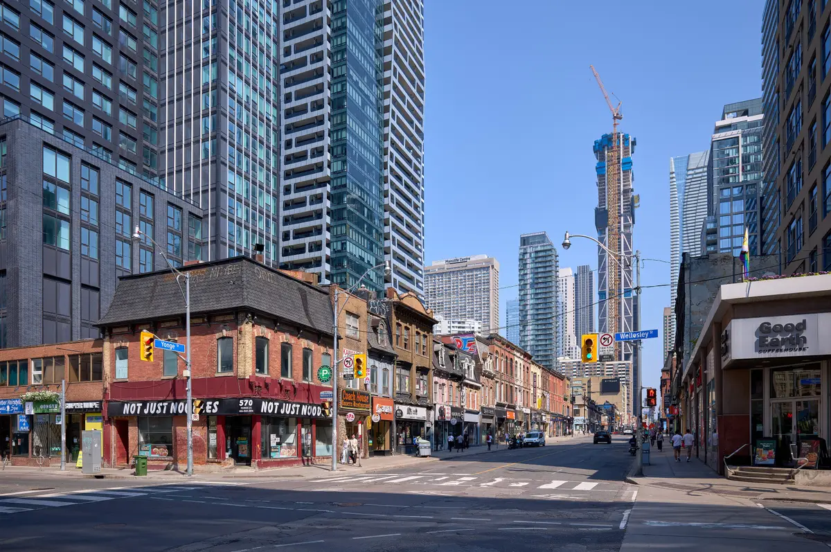
Yonge Street began as a dirt trail through forest and prairie, and today the City says it is often referred to as “Toronto’s Main Street.”
How has Yonge Street changed over time?
Quite a lot, and not in a straight line. Heritage Toronto says the road began in the 1700s as a simple dirt trail running north through rural prairies and forests. The City calls it a major early transportation corridor, often referred to as “Toronto’s Main Street.” For the story of the name, our guide to how Yonge Street got its name has you covered.
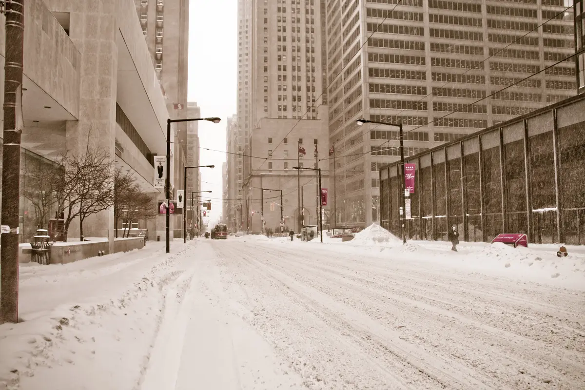
This piece goes corner by corner, south to north. Each slider pairs an archive photograph with today’s view, so you can decide what has changed and what refuses to budge. Drag it left and right, or use the arrow keys, and watch the street rearrange itself. The photographs are credited under each slider, and every building story below comes from Heritage Toronto or the City of Toronto.
What is at Yonge and Queen?
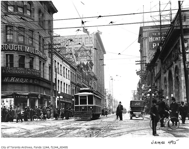
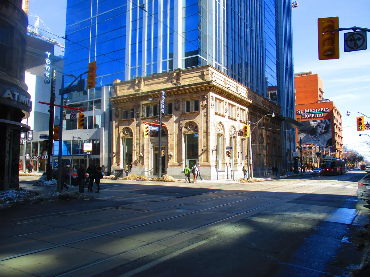
The Elgin and Winter Garden Theatre was built between 1913 and 1914 as Loew’s Yonge Street Theatre, a single building with two theatres stacked on top of each other. Heritage Toronto calls it the last operating double-decker theatre in the world. The Ontario Heritage Trust bought the building in 1981, and the complex reopened to live performances in December 1989.
Nearby, 197 Yonge Street was built as the Canadian Bank of Commerce’s Queen-Yonge branch and opened in 1905, in work by Darling & Pearson. The Massey Tower project that now incorporates it was completed in 2019. Massey Hall opened on June 14, 1894, and reopened in 2021.
How did Yonge and Dundas become a square?
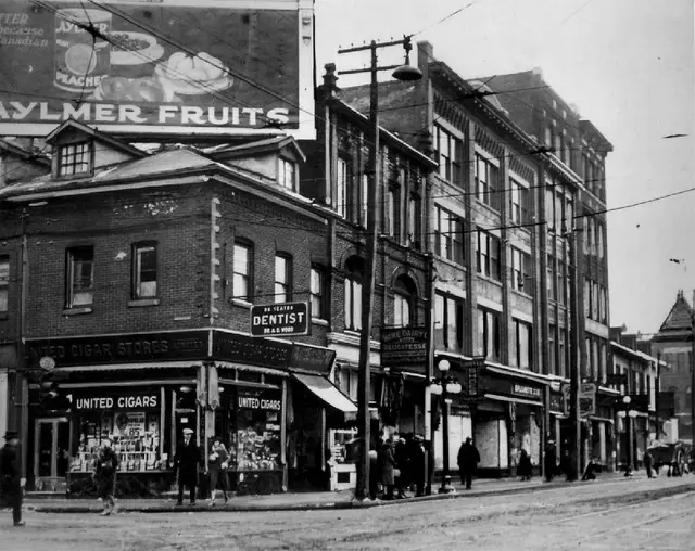
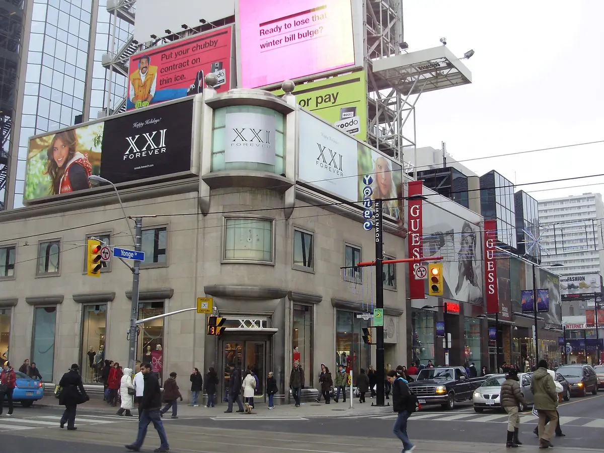
Timothy Eaton opened his first dry goods store in Toronto in 1869 at 178 Yonge Street. By 1883 its success let him buy buildings at 190-196 Yonge, roughly where the Eaton Centre stands today, and the location became known as Eaton’s Main Store. Over a century later, the first phase of the Eaton Centre opened on February 10, 1977, with the second phase following in 1979. It was designed by Eberhard Zeidler, who also designed Ontario Place, as an encased street with three levels of shops.
At the corner itself, Yonge-Dundas Square opened in 2003. The design called for a paved triangular space with outdoor seating, a raised stage and a Media Tower of large neon signs and billboards. The City now lists it as Sankofa Square (formerly Yonge-Dundas Square), a one-acre outdoor public space in downtown Toronto. Its free programs include concerts, film screenings and a busking program.
What did Eaton’s plan at Yonge and College?
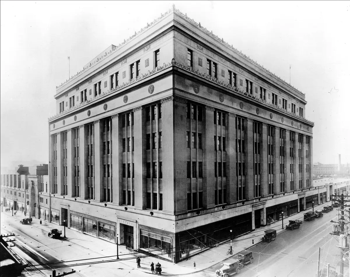
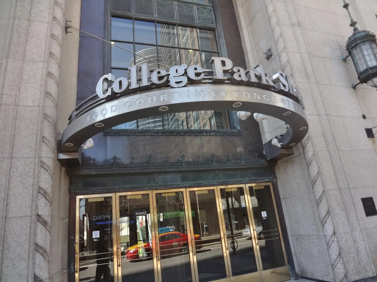
Eaton’s College Park at 444 Yonge opened on October 30, 1930. Sir John Eaton had proposed a 32-storey skyscraper at Yonge and College, with Ross and Macdonald as architects. The final building is lower and shows Stripped Classical Art Deco elements. The seventh-floor Eaton Auditorium opened in 1931 and hosted Glenn Gould’s professional debut in 1945.
A few steps away stands Oddfellows Hall at 450 Yonge, completed in 1892. Designed by Norman B. Dick and Frank W. Wickson, the four-storey building combines Gothic Revival and Chateau elements, and it is home to one of the few surviving electric Otis-Fensom elevators. Heritage Toronto adds that College Street west of Yonge had, until 1889, been a private road leading to the gates of the University of Toronto.
What is the clock tower at Fire Hall 3?
The City of Toronto Archives holds a photograph captioned “Yonge Street, looking north at Wellesley Street, 1914.” Nearby is Toronto Fire Hall 3 at 488 Yonge, built in 1871 to a design by James Grand and William Irving in the Second Empire style, with a clock tower that combines Italianate details and a mansard roof. That tower was listed in the Toronto Inventory of Heritage Properties in 1974 and designated as part of Historic Yonge Street in 2016.
This stretch sits inside the Historic Yonge Street Heritage Conservation District, which runs from College Street to just south of Bloor Street across about a kilometre of Yonge. City Council adopted its plan in 2016.
How did North York Centre become a downtown?
In the early days of North York Township, Yonge was the main thoroughfare, and the radial railway ran along it serving villages on the route. By March 1973 the Yonge subway line reached York Mills, and the work was completed in March 1974 with the opening of Sheppard and Finch stations.
Then the centre of North York took shape, one civic building at a time. North York’s third municipal building opened on April 3, 1978. By the mid-1980s the civic centre included civic offices, Mel Lastman Square, the North York Central Library, Douglas Snow Aquatic Centre and North York Memorial Community Hall, all on the west side of Yonge at Park Home Avenue. The North York Centre subway station opened in 1987. Mel Lastman Square features 20,000 square feet of open space, a garden court, an outdoor amphitheatre, fountains and a reflecting pool.
Where should you start?
Pick the corner closest to you and look up. Our downtown Toronto walking tour covers more of the core, and the Toronto history guide puts them in the wider story.
Send this to the friend who still calls it “downtown Yonge” and see which corner they pick first. More stories like this live in The Archive.
Sources (6)
- Architecture of a Neighbourhood: Downtown Yonge Street, Heritage Toronto
- Historic Yonge Street Heritage Conservation District, City of Toronto
- Sankofa Square (formerly Yonge-Dundas Square), City of Toronto
- North York Grows Up, City of Toronto
- Getting Around in North York, City of Toronto
- Mel Lastman Square, City of Toronto
Spotted something out of date? Let us know.
How did this land?
Share this
“Five Yonge Street corners, then and now. Drag the slider and see what stayed put.”