Archive DeskFeature
Toronto's Lost Rivers: Following Garrison Creek Today
Garrison Creek once ran from St. Clair to Fort York. Walk its buried valley through Christie Pits and Trinity Bellwoods and meet Toronto's lost rivers.
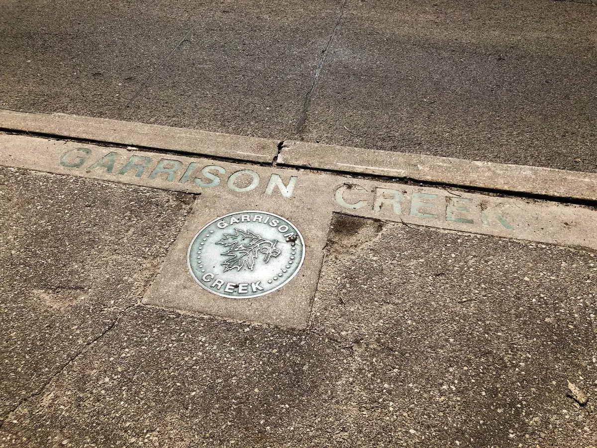
Walk south from Christie Pits and you are following a creek you can no longer see. Toronto’s lost rivers are a story told in slopes and street bends, and we think Garrison Creek is the easiest one to follow.
What was Garrison Creek?
A creek with a map and a name that tells you where it ended. Lost River Walks says it was called Garrison Creek because it entered Lake Ontario just east of Fort York, the military garrison for the region.
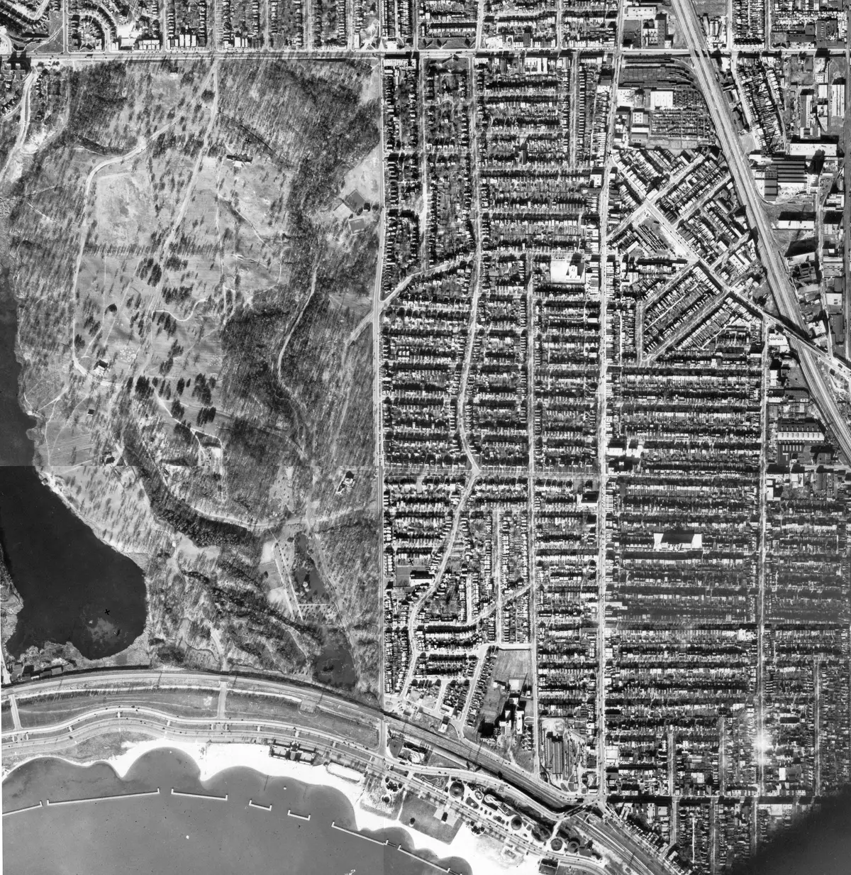
Two small streams north of St. Clair joined just north of Davenport Road, then flowed south through what are now Christie Pits, Bickford Park, Fred Hamilton Park and Trinity Bellwoods Park to Toronto Bay. The creek was 7.7 km long and had several tributaries. In its upper reaches it was also known as Bull’s Creek, because it passed through farms owned by members of the Bull family.
When Simcoe established Fort York in 1793, the City says, Garrison Creek flowed in a large deep ravine with several tributaries. The City’s walk page adds that the creek had sparkling clear water and was famous for its salmon fishing.
How old is the creek?
Older than the city by a long way. Lost River Walks says the creek had its beginnings about 12,000 years ago, as the last remnants of the Wisconsinan Glacier melted off the St. Clair West lands. Post-glacial Lake Iroquois, the forerunner of Lake Ontario, created a steep bluff along what is now Davenport Road. Indigenous peoples hunted in the area and travelled on the beach trail, now Davenport Road, the site says.
Heritage Toronto makes the wider point about Toronto’s waterways: they were once travel routes and a resource for Indigenous people, and hundreds of miles could be traversed by canoe.
Where can you still see the creek’s path?
In the parks, and in the street map. A 1998 City planning report on the Garrison Creek Linkage Plan says the creek was the largest ravine between the Humber and Don Rivers. The same report names parks on former ravine lands, including Stanley Park, Trinity Bellwoods Park, Roxton Road Parkette, Fred Hamilton Park, George Ben Park, Dufferin Grove Park, Harbord Park, Bickford Park and Christie Pits.
Look at the streets too. The report says streets that deviate from the grid, such as Walnut Avenue, Niagara Street, Heydon Park Road, Rusholme Park Crescent, Mt. Royal Avenue and Springmount Avenue, reflect the past presence of the creek. Next time a street curves for no obvious reason, check a map.
Trinity Bellwoods Park takes its name from Trinity College and covers 37.3 acres, according to the report. The report adds that it has the most extensive section of the remaining ravine. That is why we think the slopes there feel so unlike the rest of the grid.
Is there a walk that follows the creek?
Yes, and it is a good one. The City’s Garrison Creek Discovery Walk suggests starting at Christie Pits Park, across the street from Christie subway station, though you can begin at any point. The route leads along the now-buried Garrison Creek valley down to Lake Ontario, past other parks including Trinity Bellwoods and Fort York. The City estimates one hour to less than two hours.
At the end of the line, our Fort York National Historic Site guide explains what to look for. Along the way, our Trinity Bellwoods neighbourhood page collects our stories from the area.
How should you read a lost river on the ground?
Our suggestion, not an official route: go slowly and look down. At each park, stand at the top of the slope and picture the water at the bottom. Notice where the path dips, where a street bends and where one park seems to hand you on to the next. Do it on a clear day and the line of the creek becomes obvious, a long green thread through the grid. Bring a friend who likes a good mystery, and compare notes at the end of the walk.
What did the City plan to do for the creek’s valley?
The Linkage Plan, the report says, builds on a community and City initiative that began in 1994. It aims to connect isolated public parks into a system running from the original headwaters north of St. Clair Avenue to the lake. Lost River Walks adds that in 1996 the City passed a resolution calling for the revitalization of the Garrison Creek Ravine System.
Lost River Walks says the creek was completely buried by the mid 1920s. The point of the walk is that the valley is still there.
What other lost rivers can you explore?
Garrison Creek is one of many. The Lost River Walks stream menu includes Burke Brook, Castle Frank Brook, Cudmore Creek, the Lower Don River, Garrison Creek, Market Streams, Mud Creek, Russell Creek, Taddle Creek, Walmsley Brook and Yellow Creek.
The programme describes its objective as encouraging understanding of the city as a part of nature rather than apart from it, and appreciating heritage. It is a joint project of the Toronto Green Community, the Toronto Field Naturalists and community partners including Hike Ontario, and an official Ontario Legacy Trail. It offers virtual self-guided tours of Ashbridge’s Bay, Corktown Common and Parkdale on interactive maps. There is also a Taddle Creek self-guided audio tour, commissioned and produced in 2021 in association with Luminato Festival Toronto.
The City’s Uptown Toronto Discovery Walk passes the remains of a ravine where Taddle Creek once flowed.
For the bigger picture of how the ravines shape the city, see our guide to Toronto’s ravines. To see how names stick to the map, read how Toronto’s streets got their names. All of it sits in our history of Toronto guide.
Send this to the friend who loves a walk with a secret.
Sources (5)
- Garrison Creek, Lost River Walks (Toronto Green Community)
- Lost River Walks, Lost River Walks (Toronto Green Community)
- Discovery Tours, City of Toronto
- Garrison Creek Open Space Linkage Plan, City of Toronto
- Carleton and Jarvis Lost Rivers, Heritage Toronto
Spotted something out of date? Let us know.
How did this land?
Share this
“Saving this for a walk: Toronto has lost rivers you can follow on foot, starting at Christie Pits.”