City DeskGuide
The PATH Toronto Guide: A Winter Route Underground
Toronto's downtown PATH links subway stations, Union Station and big attractions. Here is how it works, how to read the signs and where to start.
When the wind comes off the lake, Toronto keeps a quiet trick up its sleeve: a way to cross a good part of downtown without putting your hat on.
What is the PATH?
The City of Toronto describes the PATH as a mostly underground pedestrian walkway network in downtown Toronto that spans more than 30 kilometres of restaurants, shopping, services and entertainment. It links people to public transit and accommodates more than 200,000 business-day commuters, as well as tourists and residents.
Winter is when it earns its keep. The City’s own walking guide says the underground location gives pedestrians a safe haven from the winter cold and snow, and from the summer heat too.
One thing to know early: the PATH is not a single mall. Each segment is owned and controlled by the owner of the property it runs through, and about 35 corporations are involved. The Toronto Financial District BIA puts it vividly: most of the network is privately owned, so you are walking through the basements of about 75 different properties. Our take is to expect the look of the corridor to change as you pass from one building to the next, and to treat that as part of the walk.
What does the PATH connect to?
More than 75 buildings connect to it. Six subway stations, three major department stores, nine hotels and Union Station are accessible through the PATH.
The City also lists some big-ticket destinations on the network: the Hockey Hall of Fame, Roy Thomson Hall, the Scotiabank Arena and CF Toronto Eaton Centre, with City Hall and Metro Hall connected too. That gives you a ready-made menu for a cold day: a show, a game, a museum, some shopping or a civic wander.
Two long corridors are worth knowing. The City says it is possible to walk through the PATH from the waterfront to Downtown Yonge, and from the Entertainment District to Yonge Street. The network keeps growing, too. The BIA reports that a new underground tunnel between Simcoe Place at 200 Front Street West and 160 Front Street West was completed in 2024.
How do you find your way?
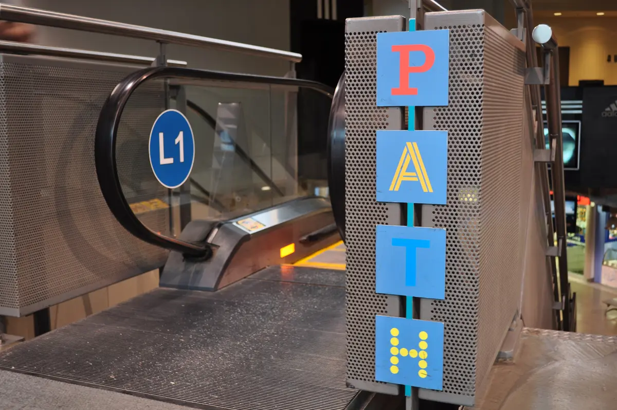
The PATH has had a signage makeover. In 2016 and 2017, the City and the Toronto Financial District BIA hired Steer Davies Gleave to develop a new wayfinding system. After public consultations, conversations with property managers and review by the PATH Partnership Group, the new wayfinding was installed throughout the PATH in spring 2018.
In practice, the BIA says the update brought wall maps, physical signage and downloadable maps, with coloured pathways that help users plan a route. Destination markers help on longer stretches. Signage labelled “Waterfront”, for example, identifies the route south to Lake Ontario.
Here is our quick method for a first visit:
- Download a map before you leave home. The BIA publishes a network map and directory, a simplified map, and printable north, central and south sections. The BIA says there is currently no app for the PATH map, but downloadable maps are available.
- Pick a destination marker, such as the waterfront, and follow the signs for it.
- Check the map’s accessibility notes. The PATH maps identify grade changes and alternate elevators or ramps.
The PATH’s name and logo are registered to the City, which co-ordinates the directional signage, maps and identity markers throughout the system. So when you see that logo, you are following the City’s map language.
Where should a first-timer start?
Our pick is Union Station. The City’s revitalization project concluded in July 2021, and it widened the way into the PATH. Before, PATH access from the station was only through the TTC. Now the Bay Concourse connects to the PATH through the Bay retail area. That concourse opened to the public in July 2021. The York Concourse, which opened in 2015, also offers easy connections to train platforms, the subway and the PATH.
Glass covers now sit over the station’s pedestrian moats, creating an enclosed space with protection from inclement weather. The Great Hall also received significant restoration work to preserve the station’s original heritage. If you have ten spare minutes, look up before you head underground. For more on the station itself, see our Union Station guide.
A winter route plan, by mood
We built these around the destinations on the City’s list, so you can fill in the details from the official maps.
- A show or game night. Pair a PATH walk with the Scotiabank Arena or Roy Thomson Hall.
- A shopping run. Head for CF Toronto Eaton Centre, which the City lists on the network.
- A hockey history stop. The Hockey Hall of Fame is on the City’s list of PATH links.
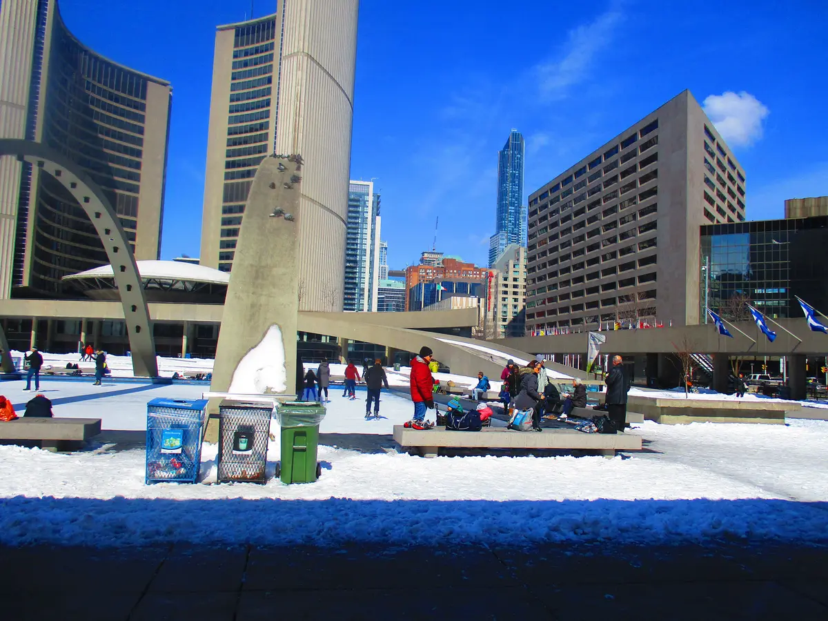
- A civic wander. City Hall and Metro Hall are both connected through the PATH.
If you want the bigger winter picture, our winter in Toronto guide collects the best cold-weather plans, and our indoor winter ideas and winter date ideas pair well with a PATH start.
A short history of the PATH
It began small. The first underground path in Toronto dates to 1900, when the T. Eaton Co. joined its main store at 178 Yonge Street and its bargain annex by tunnels. When Union Station opened in 1927, an underground tunnel connected it to the Royal York Hotel, now the Fairmont Royal York. The real growth of the PATH began in the 1970s, when a tunnel was built to connect the Richmond-Adelaide and Sheraton Centres.
The BIA adds that the network is a popular location for pop-up markets, lunchtime concerts and other seasonal events. It is worth checking what is on before you set out.
Plan your PATH day
Send this to the friend who says they hate winter walks. The PATH might change their mind, and at the very least it will keep their boots dry.
Sources (5)
- PATH: Toronto’s Downtown Pedestrian Walkway, City of Toronto
- Services (PATH FAQ), Toronto Financial District BIA
- Maps, Toronto Financial District BIA
- Where to Walk, City of Toronto
- Union Station Revitalization Project, City of Toronto
Spotted something out of date? Let us know.
How did this land?
Share this
“Winter walking plan for downtown Toronto: the PATH, explained from the City's own pages, with a route that starts at Union Station.”