City DeskGuide

Mimico Toronto Guide: A Lakefront and Village Loop

Humber Bay parks, a Calatrava bridge, the Waterfront Trail and two village main streets: one easy Mimico afternoon in south Etobicoke, block by block.

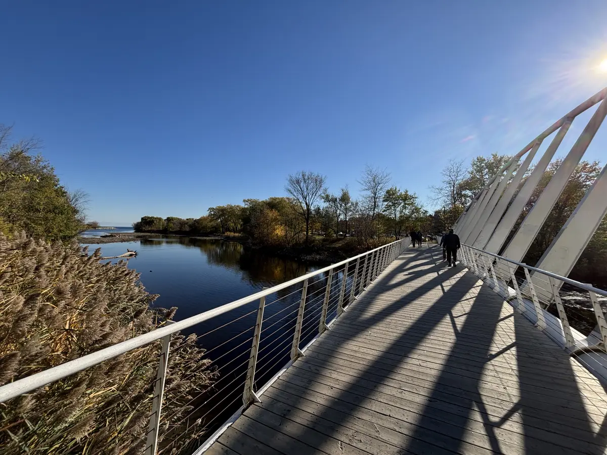
A white steel footbridge with a tilted arch crossing Mimico Creek, with a walker on the deck and Lake Ontario beyond the reeds
Canmenwalker / Wikimedia Commons / CC BY 4.0

Some neighbourhoods make you choose between the lake and the main street. Mimico hands you both inside one easy afternoon, with a train station at the end of the loop to carry you home.

Where does the name Mimico come from?

The City of Toronto’s 2019 cultural loops guide says Mimico’s name originates from the Ojibwe word “Omiimiikaa,” which means “place of the wild pigeon.” Mimico developed primarily as a residential area west of Mimico Creek, and it was incorporated as an independent village in 1910 and as a town in 1917. If you like the backstory, our history of Etobicoke tells how the whole lakeshore grew.

How do you get to Mimico?

The City’s 2019 guide says to take the 501 Queen streetcar westbound and get off at Royal York Road, or take the GO train to Mimico GO station and head south on Royal York Road to Lake Shore Boulevard. For the park end of the loop, the guide says to exit the streetcar opposite 2111 Lake Shore Boulevard West, go one block east to Marine Parade Drive and turn right to head south to Humber Bay Park East.

Metrolinx is also investing in the station. Its GO Expansion program includes the capacity for trains every 15 minutes or better on the Lakeshore West line, and Metrolinx is upgrading Mimico GO Station to enhance the customer experience and ensure barrier-free access. Planned upgrades include a new east connection with elevator and stair access to the platform level and a new south tunnel entrance at Manchester St. and Blue Goose St.

The City’s 2019 guide suggests about an hour and a half for its walk, bike or drive through the Humber Bay Shores parks and Mimico. Give yourself an afternoon and add a snack stop or two.

Start where the streetcar leaves you. The City’s 2019 guide notes that the Humber Loop serves as a station for the 501 Queen streetcar. Humber Bay Park is a destination park of over 43 hectares on Toronto’s waterfront, defined by two peninsulas bisected by Mimico Creek: Humber Bay Park East and Humber Bay Park West.

The City’s guide describes the east side as man-made land at the mouth of Mimico Creek, with views of Lake Ontario and the city skyline and trails for walking, hiking and biking. Good news for your timing: the City’s July 2026 update says Humber Bay Park East has reopened, with remaining planting and site furniture to be finished by fall 2026. The City’s Master Plan page lists improvements for the east side that include a revitalized wetland system and pond, and upgraded walkways, boardwalks and bridges. The 2019 guide adds that Humber Bay Shores Park is part of the Martin Goodman Trail system, which connects Etobicoke to Toronto’s east end along the waterfront.
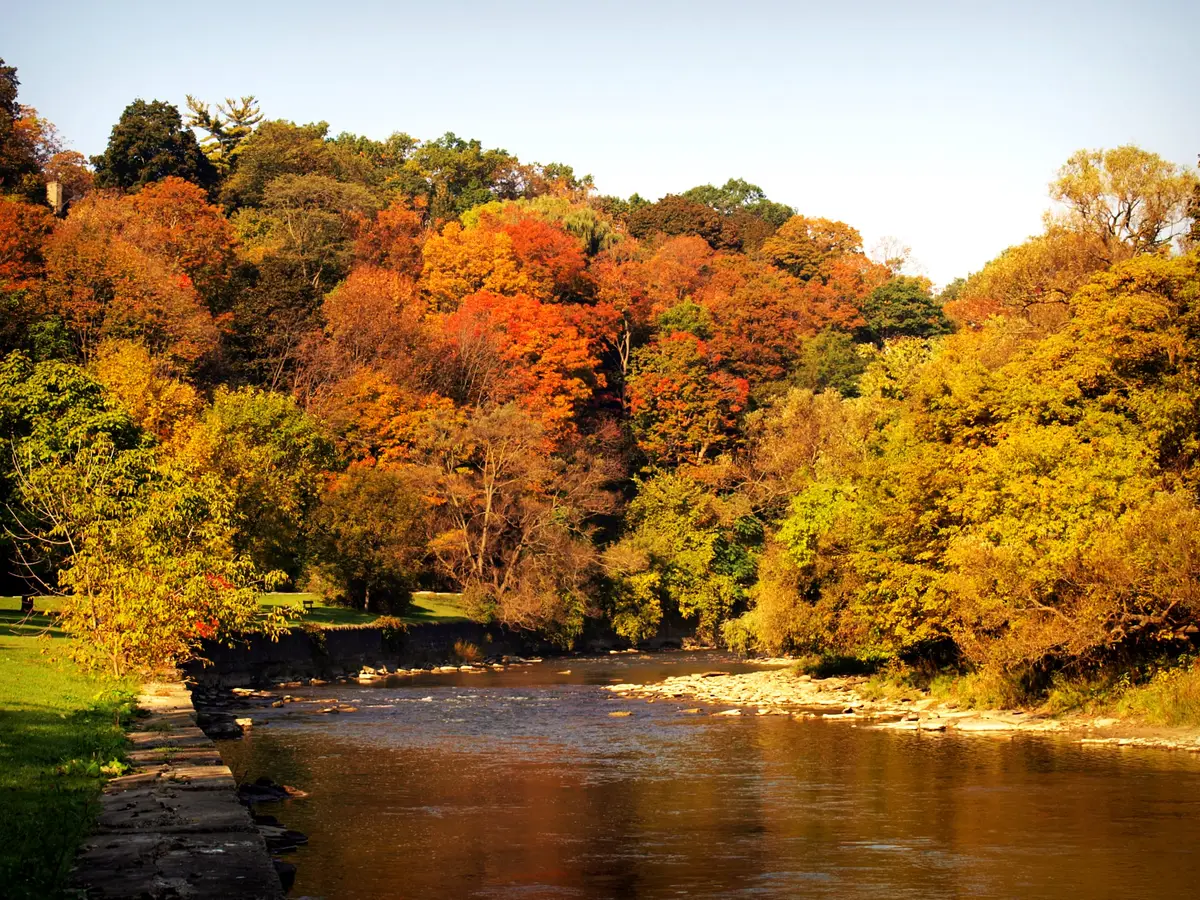
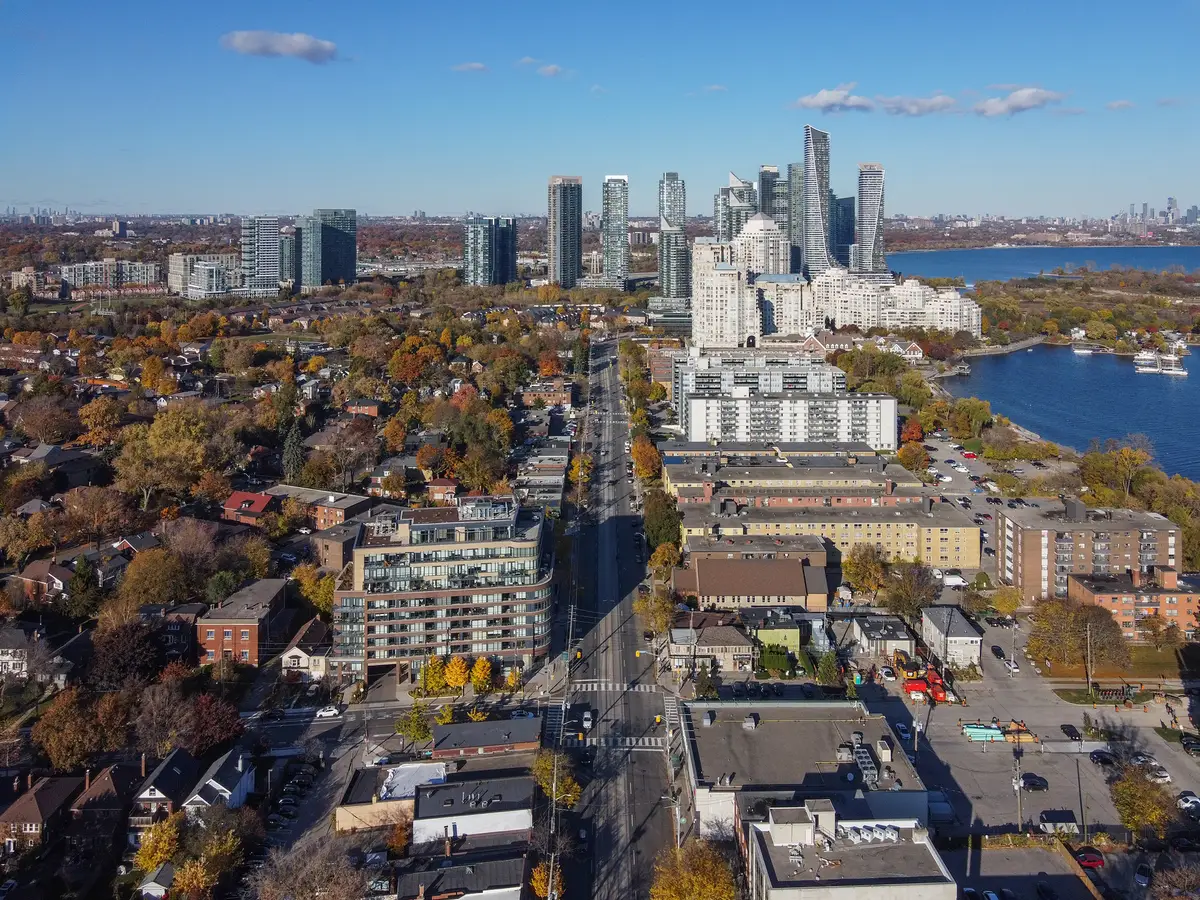
Follow the trail to the bridge. The City’s 2019 guide places it at the southern end of Mimico Creek, where it connects the two Humber Bay parks. The guide credits Spanish architect Santiago Calatrava with the design and describes a one-sided tilted arch. It is the photo stop of the loop, so take your time.

Cross over and you are on the west peninsula, which the City’s guide describes as having trails, picnic areas and an off-leash area for dogs, plus scenic views of Lake Ontario. The same guide says the lake offers recreation like kayaking, sailing and kiteboarding, so keep an eye out for a sail or two.

Keep heading west on the water’s edge. Mimico Waterfront Park provides 1.1 kilometres of shoreline park space between Norris Crescent Parkette and Humber Bay Park West. Its final 500 metres opened in October 2012 and provided the missing link in the city’s waterfront trail, letting Torontonians enjoy the lakefront west of Humber Bay Park West for the first time. That stretch added a 250-metre cantilevered boardwalk, a separate multi-use trail along the backshore, small pockets of wetland habitat, landscaping and park lighting.

The first phase created two small headlands, three cobble beaches and a rounded shoreline at the foot of Superior Avenue. Further along, Amos Waites Park has a partly sheltered embayment, a boardwalk and a sand dune feature in the backshore. The park was designed with sustainability and the native ecology of the area as key considerations.

You are also near the Great Lakes Waterfront Trail, which the City’s 2019 guide describes as mostly paved and connecting over 140 communities and hundreds of green spaces. The guide says it connects along the waterfront to the Martin Goodman Trail to the east.

Mimico Waterfront Park, 2026: cobble beach, rock headland and the trail.Chicken4War / Wikimedia Commons / CC BY-SA 4.0

Turn up to street level and the loop becomes a village walk. The Mimico by the Lake BIA is located along Lake Shore Boulevard West between Allen Avenue and Alexander Street, and it includes retail shops, restaurants and cafes, health and wellness providers, and professional services. The BIA was established in 1985, and it provides annual events such as the Summer Music Series, Pumpkin Parade and Winter Tree Lighting.

Look up as you go. The City’s 2019 guide says that along Lake Shore Boulevard, many murals have been painted over three decades that celebrate the area’s community members, local history, nature and wildlife. It describes a 2017 abstract-style mural at 2336 Lake Shore Blvd. W., designed by artist and designer Herman Mejia as a tribute to Mimico, that depicts the Toronto skyline, Mimico’s main streets, the lakeshore and a pigeon. Murals do get refreshed, so treat this as a pointer rather than a guarantee. For a bigger mural adventure, see our walk through the Islington Village murals.

When the walk makes you hungry, our Etobicoke restaurant route has a few ideas in this stretch.

Head north for the second main street. The Mimico Village BIA is located along Royal York Road from Evans Avenue in the north to Judson Street (GO Station) in the south. It partners with local community organizations to organize the annual Tulip Festival every May, featuring music, entertainment, food and family activities. Mark May on your calendar and check the BIA’s site for the date.

Royal York Road at Judson Street, under the rail bridge by Mimico GO, 2008.GTD Aquitaine / Wikimedia Commons / Public domain

End at the station and ride home. It sits at the south end of the Mimico Village strip, and Metrolinx has made it part of its Lakeshore West upgrades.

Where does Mimico fit in Etobicoke?

It is one piece of a bigger puzzle. Our Etobicoke neighbourhood hub gathers the walks, meals and history in one place. Send this to the friend who always says there is nothing to do near the lake.

Sources (7)
  1. Cultural Loops Guide: Explore Etobicoke, City of Toronto
  2. Humber Bay Park Master Plan, City of Toronto
  3. Mimico Waterfront Park, Waterfront Toronto
  4. BIA List: F-P, City of Toronto
  5. Mimico by the Lake, Mimico by the Lake BIA
  6. Mimico GO Station, Metrolinx
  7. A Brief Overview of Etobicoke's Historic Communities, Etobicoke Historical Society

Spotted something out of date? Let us know.

How did this land?

Share this

“Saving this for Saturday: a Mimico loop with a Calatrava bridge, the Waterfront Trail and a village main street.”